US Forest Service OSM Mashup
While scoping out my next backpacking adventure via various PDF and web maps, I ran across these US Forest Service vector tile basemaps.
I have to hand it to whomever created these styles, as they are gorgeous. The main style is quite extensive, with over 700 layers, and all with very eccentric naming conventions.
[
  "Transportation/MVUM Plus GTAC/Road, Not Maintained for Passenger Car_2/0",
  "Populated Places/Generalized Place Names 225 Mile Grid GTAC/label/150k - 500k"
]
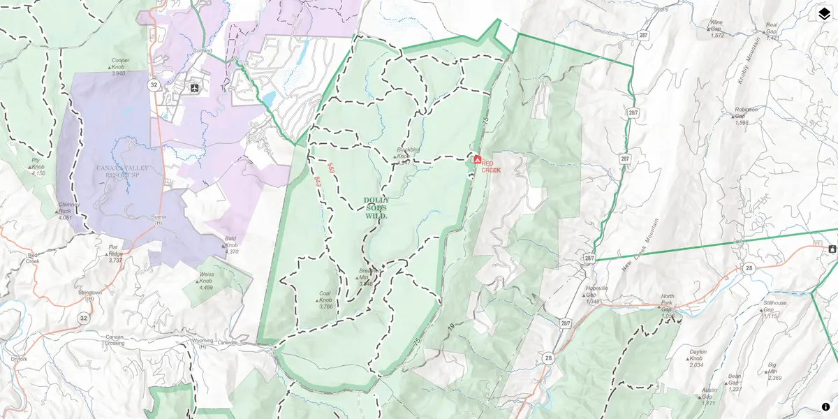
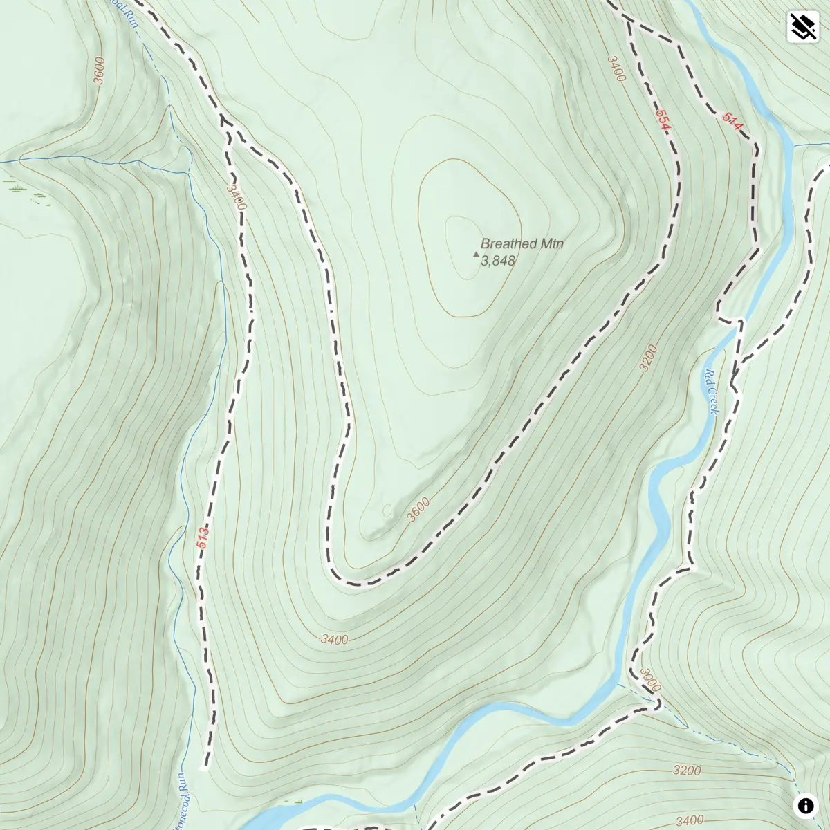
However, I noticed that the maps are missing several key pieces of data for my journey, notably campsites and side trails. But since the vector tiles are public, we can use them along side the new OpenStreeMap shortbread tiles to create a web map mashup to fill in the missing data. And all without downloading any data to our local computer, fussing with messy data transformations, generating any data exports, or hosting any data ourselves.
Using USFS vector tiles and published style as-is as the foundation, I added a few key features from the OSM tiles - streets and pois. These contain unofficial side trails, campsites, and peaks missing in the official USFS data.
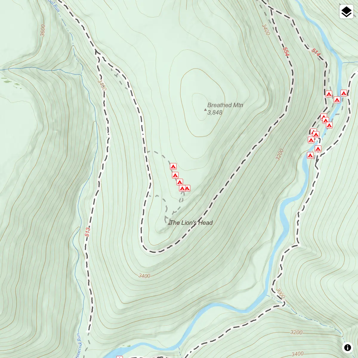
The most difficult piece of this approach is understanding the schemas of the OSM and USFS tiles. But once you understand these the possibilities are endless. You can tweak styles, add or hide layers, and experiment with different combinations of trails, points of interest, and terrain features on the fly. For anyone planning a hike, bike trip, or just exploring public lands, a mashup like this is a quick way to see both the "official" and "community" data all in one place.
You can check out the live example here.